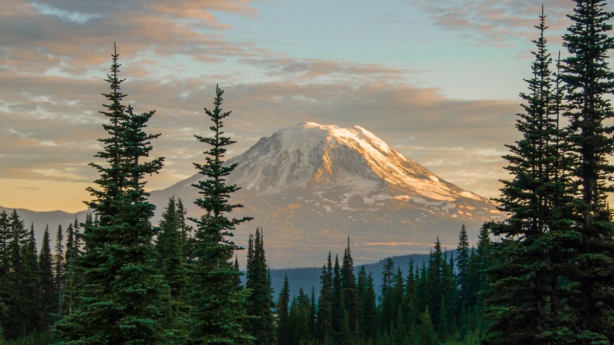
Scientists have recorded a significant uptick in earthquakes at the Mount Adams volcano — the largest active volcano in Washington state.
Six earthquakes hit the “high threat” volcano in September, according to the United States Geological Survey (USGS), which is a drastic increase from the normal rate of one earthquake at the volcano every two to three years.
This is the largest number of earthquakes recorded at Mount Adams in a single month since records began in 1982. The earthquakes ranged from magnitudes 0.9 to 2 and were recorded via a single seismic station 7 miles (11 kilometers) southwest of Mount Adams’ summit. None of the ground shakes were felt at the surface.
According to experts, these earthquakes do not mean an eruption is imminent. “Currently, there is no indication that the level of earthquake activity is cause for concern,” USGS representatives wrote in a statement.
Efforts are underway to better understand what’s happening beneath the volcano. Scientists with the Cascades Volcano Observatory (CVO) and Pacific Northwest Seismic Network (PNSN) will install a set of temporary seismic stations in the area to get a better understanding of the size, location and depth of the seismic activity, according to the statement.
Mount Adams towers more than 12,000 feet (3,660 meters) above Earth’s surface and stretches 18 miles (29 km) across, making it one of the largest peaks in the Cascades mountain range. It sits around 70 miles (110 km) northwest of Portland.
Related: ‘Mountain of God’ volcano in Tanzania is bulging, study finds
The volcano formed around 520,000 years ago. The largest cone grew during three eruptive episodes — 500,000, 400,000 and 50,000 to 30,000 years ago — and is surrounded by several smaller vents.
It last erupted at some point between 3,800 and 7,600 years ago, according to USGS. Generally, the volcano has produced effusive eruptions, which involve slow-moving lava flows, rather than more destructive explosive eruptions.
“The greatest threat to people living near Mount Adams are lahars (muddy flows of rock, ash, and ice that surge downstream like rapidly flowing concrete) that could occur during eruptive or non-eruptive periods,” representatives wrote in the statement. “The ice-capped summit conceals large volumes of hydrothermally weakened rock, and future landslides of this weakened rock could generate far-traveled lahars.”
CVO and PNSN scientists will start monitoring data from the temporary seismic stations, which along with information from the permanent station, will allow them to find smaller earthquakes and understand the cause of the recent events.
“The results of our findings will determine if any additional actions are needed,” representatives wrote.


